
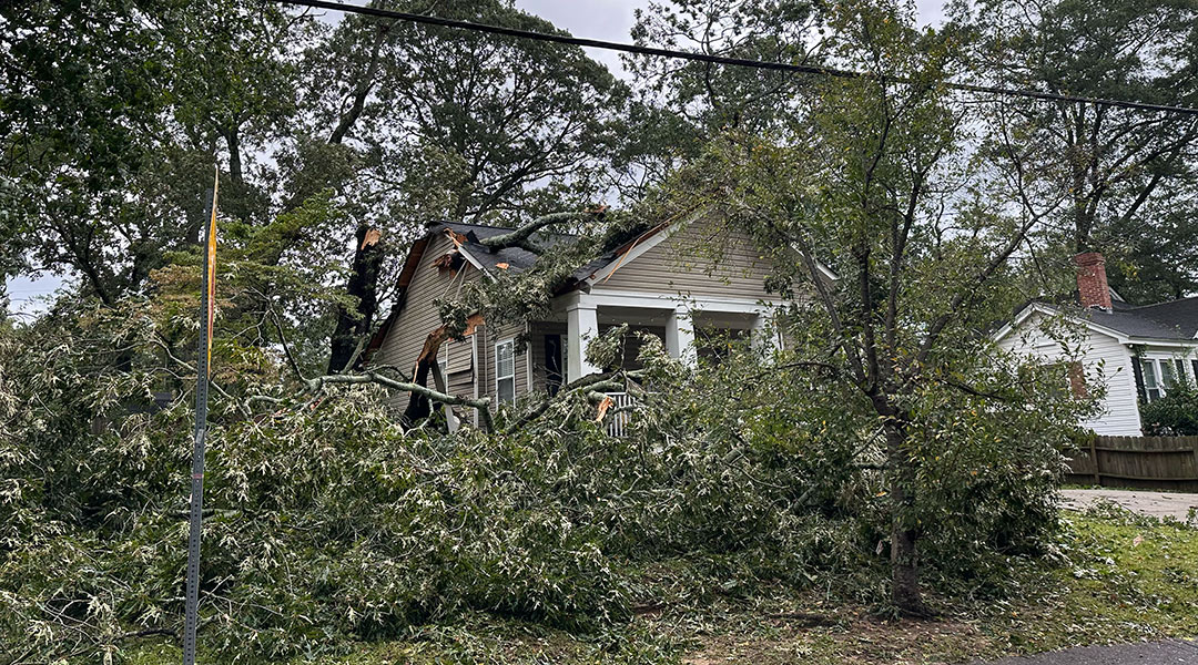
A tree fell on a house on South Woodrow Street in the Rosewood neighborhood. (Photo by Annie Poteat/Carolina News & Reporter)
Hurricane Helene made landfall on Florida’s Gulf Coast Thursday night and caused a large loss of power across Georgia, Florida, North Carolina and South Carolina.
Many fallen trees blocked roadways across in Columbia and across Lexington and Richland County, particularly in downtown Columbia.
Helene became a Category 4 storm just after 6:30 p.m. Thursday with sustained winds anywhere from 130-156 mph.
Its predicted inland path took it just west of South Carolina. But Helene was a large system, with the Weather Channel reporting tropical storm-force winds extending 345 miles from the center.
The storm traveled past South Carolina just before day break Friday.
Many of Columbia’s roads and the Blossom Street bridge were closed early Thursday afternoon due to flooding. The city of Columbia also opened its homeless shelter.
The University of South Carolina campus announced just after 2 p.m. closures for late afternoon Thursday and Friday. Local K-12 school districts also announced similar closures. Richland County government offices also closed Friday.
Columbia residents should avoid any flood-prone streets or intersections and keep an eye on water levels in any stream or river in case of flash flooding.
Much of South Carolina was under either a tropical storm watch or a tropical storm warning Thursday. The Midlands and the Upstate also were under flash flood watches.
“As it continues to move inland, we’re going to get some heavy rain to develop,” said forecaster Chris Landolfi of the National Weather Service in Columbia.
Heavy rain started Thursday afternoon and continued into the night and through Friday morning. Weather stations across the state were calling for 3 to 5 inches of rain in Columbia, while the Upstate could get 6 to 10 inches.
State officials reported that 7 inches of rain had fallen by 6:30 p.m. Thursday. Another 2 to 4 inches is predicted to fall by Friday morning.
“That could lead to some flash flooding,” Landolfi said. “We’re also expecting the potential for some pretty strong wind gusts.”
The weather service predicted wind gusts from 40 to 50 mph in the Midlands, while the Upstate faced 60 to 70 mph gusts. The threat of tornadoes brought about by the system was a concern for those in the state below I-20, or south Lexington.
The weather service in Charleston issued a tornado warning for Bluffton on Thursday morning and tornado watches from Newberry to Savannah.
A tornado was spotted on radar in Bamburg and Orangeburg County on Thursday afternoon, according to the National Weather Service in Columbia. One was also spotted on radar near Turbeville, Mayesville, and Lynchburg SC.
Gov. Henry McMaster declared a state of emergency Wednesday afternoon ahead of the storm’s arrival.
Robert Anderson, director of public works for Columbia, said the city is prepared to handle any fallout.
Along with the closure of many flood prone streets around the city, Columbia had forest crews on standby for any calls about fallen trees and responded as early as Thursday night, Anderson said.
“If you do see a tree or limb down on the road, always think about a power line being there,” Anderson said. “Do not touch it. We do not need anybody electrocuted.”
Columbia’s rivers also could be an issue after the storm passed, with the higher rain totals in the Upstate.
“As that water flows down, we can get some river flooding across the states, especially the central portions of the state, that could continue into the weekend,” Landolfi said.
Downtown Columbia’s flood-prone streets and intersections:
Adger and Devine
Barnwell and Pendleton
Blossom and Henderson
Blossom and Pickens
Blossom and Saluda
Bull and Calhoun
Bull and Laurel
Cannon (3300 block)
Catawba (1200 block)
Columbia College Drive and North Main
Duncan (3200 block)
Franklin and Marion
Franklin and Sumter
Gervais and Laurens
Harden and Calhoun
Harden and Read
Harden and Santee
Heyward and Ravenel
Main and Catawba
Main and Whaley
Monroe (entire 3200 block)
Monroe and Maple
Pickens between Wheat and Greene
Sumter (300 block)
Wheat (1400 block)
Wheat and Amherst
Wheat and Pickens
Wheat and Sumter
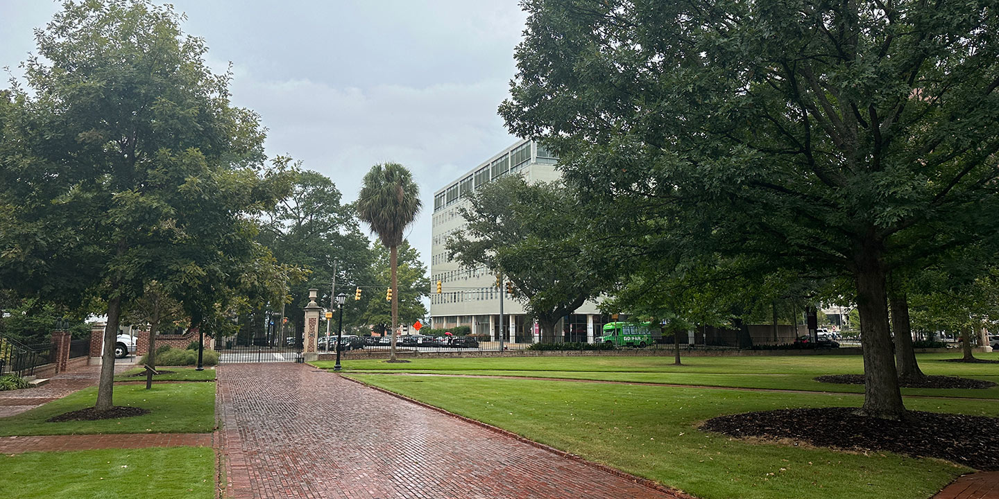
Rainfall starts out light Thursday morning for Columbia. It’s expected to intensify later into the night and Friday morning. (Photo by Annie Poteat/Carolina News & Reporter)
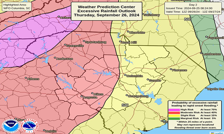
Rainfall outlooks for the state of South Carolina. The Upstate and western parts of the Midlands are expected to be effected the most. (Graphic by the National Weather Service/Carolina News & Reporter)
