
By MADISON POINDEXTER and MARIA JUTTON
Wet leaves squish under master naturalist Bob Askins’ feet as he walks down the elevated boardwalk at Congaree National Park toward Weston Lake.
He follows the winding path through the old-growth forest. Tall pines and mostly bare trees create a thin, brown canopy 150 feet high. Aside from occasional bird calls or squirrel chatter, hearing other wildlife is slim this time of year. A mile and a half down the trail, Askins reaches the end of the elevated boardwalk, where the trail descends farther into the forest.
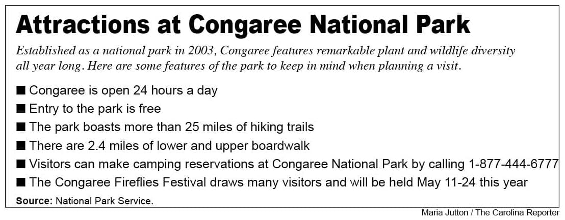
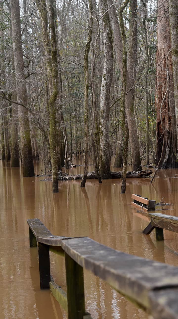
On this day, the lower boardwalk is completely underwater.
After three decades of visiting the park and five years as a master naturalist and volunteer tour guide, Askins doesn’t let flooding stop him from enjoying the Congaree. As he points out, high waters don’t drown out the features that make the Congaree special.
“There’s lots of little things you can notice while walking in the park,” Askins says. “I could stay out here all day.”
The benefits of fire and flood
At Congaree National Park, most low-lying trails are underwater. But flooding is a process that is beneficial to the park’s floodplain environment.
Greg Cunningham, chief of interpretation, education and visitor services at the park, says people sometimes have a negative view of such weather events.
“As a society, we tend to think of floods and fires as something just bad,” Cunningham says. “In the right places like Congaree, both fire and flood can be very beneficial to ecosystems.”
The Congaree and Wateree rivers flood the region about 10 times per year as a natural process of the ecosystem. The rivers drain an area the size of Maryland, one that stretches to the foot of the Appalachian Mountains. With every flood, sediment from the rivers enriches the soil and helps trees grow taller and faster. Flooding also washes away invasive species that can’t survive in the ever-changing floodplain, allowing the native wildlife to flourish.
The most recent flood crest in early February was one of the highest water levels recorded since 1985, second only to the 2015 floods.
“This is a significant flood for the last 30 or 40 years, but at Congaree that’s natural,” says David Shelley, chief of resource stewardship and science for Congaree National Park. “Ultimately, the flood plain in terms of natural systems and ecology, its role is to catch this water.”
Thirty-five million acres of old-growth forest once covered the eastern United States. Ninety-seven percent of that habitat is gone, and Congaree is the largest intact section left. Shelley believes visiting Congaree National Park is an opportunity to tangibly connect with history.
“This is a chance to experience a bit of the raw wilderness out of which our society in the South has evolved and developed,” Shelley says.
Visitors come from around the world to take advantage of the experiences the national park offers. Askins enjoys giving tours and talking with people from different backgrounds.
“I’m always amazed at how many people come from places very far away and they come just to see this park,” Askins says. “I think sometimes we forget how fortunate we are to have a resource like that so close by.”
Volunteers from the community help maintain the integrity of the park’s natural resources and keep it running smoothly for visitors. Although the park only has 15 full-time staff members, it relies on a network of 150 to 200 core volunteers.
“It’s not my park, and it’s not the National Park Service’s park,” Cunningham says. “It’s the American people’s park, and together we can take care of it and make it what it needs to be. We can’t do it on our own.”
Askins looks through his binoculars at the sparse canopy of loblolly pines and pink-tinged maples. Although he doesn’t spot many birds due to the chilly temperature, he does admire the history the trees hold in their roots.
“It’s just a fraction of what it once was,” Askins says. “It represents what’s possible, what the potential is if we don’t mess with it too much.”

A bridge at Cedar Creek Canoe Landing sits barely above water level at Congaree National Park. Usually, visitors can canoe under the bridge.
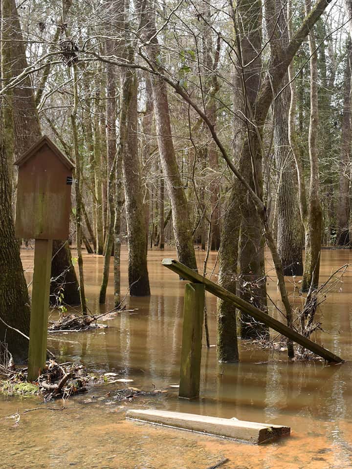
A staircase descends into floodwaters beside the bridge at Cedar Creek Canoe Landing.
Water covers the lower levels of the boardwalk at Congaree National Park.
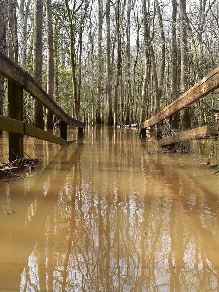
A bench next to the lower boardwalk is almost completely covered by floodwaters.
